Jirisan Dullye-gil
Jirisan Dullye-gil
Self Realization through Walking Culture
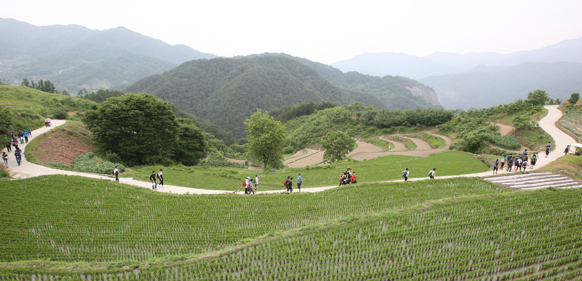
'Dullye-gil' literally means a road or trail going around mountain. Jirisan Dullye-gil is about 300km long walking trail connecting many roads in mountains, rice fields and villages as well as the ones along river shores covering more than 100 villages in 5 cities and districts (Gurye, Namwon, Hadong, Sancheong and Hamyang) in 3 Dos (provinces) (Jeollabuk-do , Jeollanam-do and Gyeongsangnam-do). The trail is planned to be completed in 2011 as a project performed by National Forestry Administration. Currently the section from Jang-an-ri, Jucheon-myeon in Namwon City to Sucheol-ri, Guemseo-myeon in Sancheong -gun, 71 km long is completed to walk along.The section of the trail going through Hamyang-gun includes banks, farming roads and forest trails connecting various towns for walkers to feel free to view the villages, mountains and valleys in the district.
Walker's Promises for Jirisan Trail Preservation
- 1The Walker prepares all the preparation by him/herself.
- 2Small group walk rather than a large sized group is recommended.
- 3A walker does not touch any farm products or fruits.
- 4A walker behaves nicely to local residents and asks permission prior to taking photographs.
- 5Public transportation is highly recommended. And, please come by Jirisan Dullye-gil Guide Center.
- 6A walker acknowledges time on Jirisan Dullye-gil is a precious opportunity for self-realization.
- 7A walker does not accompany pets to walk on Jirisan Dullye-gil.
Preparation
The Guide Map, Compass, Backpack, Mountain Climbing to Tracking Shoes, Water Container, Jacket (Wind and Water Proof, Long Sleeves), Easy to Move and Comfortable Wears and Additional Cloths (Functional Mountain Wear Recommended), Toiletries, Rain Gears. Hat, Globes, Lantern, Spoon and Utensils, Cup, Handkerchief, Pen and Paper, Socks, Personal Identification, Safety Kit, Simple Foods. And, for personal interests, telescopes, binoculars, magnifying glass, camera and field guides are recommended.
Jirisan Dullye-gil Contact Info.
- Jirisan Dullye-gil Contact Info.
- Culture & Tourism Section 055-960-4530
- Dullye-gil Guide Center 055-964-8200
- Organization, 'Sup Gil' http://trail.or.kr
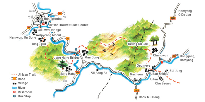
Inwol - Geumgye Section
- Distance: 19.3km
- Estimated Time: 8 Hours
Namwon City, Inwol-myeon, Inwol-ri in Jeollabuk-do and Macheon-myeon, Hamyang-gun in Gyeongsangnam-do are connected along the mountain trail. Inwol - Geumgye Section includes Sanghwang Village in Namwon City, the Northern area of Jirisan and a part of the main ridge of Jirisan centered with Deunggujae (Pass), an old hill trail connecting Changwon Village in Hamyang-gun. The section provides many assorted views and roads on banks and farms as well as forest paths via 6 mountain villages connecting Eomcheongang(River).
Route Information
Inwol-myeon - Junggun Maeul - Suseongdae - Baeneomijae (Pass) - Janghang Maeul - Janghang Bridge - Seojinam 3 Ways - Sanghwang- Deunggujae (Pass) - Changwon Maeul - Geumgye Maeul
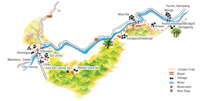
Geumgye - Donggang Section
- Distance: 11km
- Estimated Time : 4 Hours
The Trail of Geumgye - Donggang Section connects two places of Hamyang-gun, Geumgye Maeul in Macheon-myeon and Donggang-ri in Hyucheon-myeon. This 15 km long quiet forest trail leads to 6 villages and temples in deep Jirisan Mountain area and, later, meets Eomcheongang(River) showing great views of Deungujae (Pass) and skirt of Beophwa.
Route Information
- Geumgye Maeul - Eui Jung Maeul - Seoamjeongsa (Temple) - Byeoksongsa (Temple) - Eui Jung Maeul
- Geumgye Maeul - Eui Jung Maeul - Mo Jeon Maeul(Yong Yu Dam) - Sedong Maeul - Unseo Maeul - Gusirakjae (Pass) - Donggang Maeul
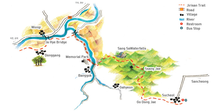
Donggang – Sucheol Section
- Distance: 11.9km
- Estimated Time: 5 Hours
This route is a part of Jirisan Trail connecting Donggang-ri in Hyucheon-myeon of Hamyang-gun and Sucheol-ri in Geumseo-myeon of Sancheong-gun. Walking on this 12km trail, 4 villages will be met along the beautiful valley and a memorial park to remember recent unpleasant history during the war while enjoying slow walk through the mountain forest.
Route Information
- Jeomchon Maeul - Sancheong Hamyang Incident Memorial Park - Sangsa Waterfalls - Ssangjae (Pass) - Godongjae (Pass) – Sucheol Maeul